Rutgers collaborates with universities, companies on GliderPalooza project

Peter Moore used to work as a partner in a fishing company in New Bedford, Mass., overseeing over 100 employees in the plant. For a while, production was up to speed.
Then business started to dwindle as the local population of Atlantic mackerel began to disappear from the waters.
The shift of the mackerel population is largely attributed to the rising temperature of deep waters, Moore said.
He now works as the stakeholder liaison for the Mid-Atlantic Regional Association Coastal Ocean Observing System. The association inspired Rutgers to get involved in the GliderPalooza initiative, which seeks to uncover answers to this phenomenon.
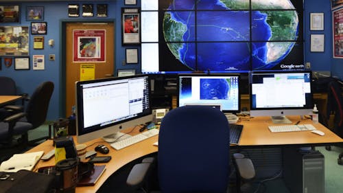
Through the project, Rutgers collaborates with other universities, companies and federal agencies to build an observing network that spans from Cape Hatteras, North Carolina to the Canadian border, said Oscar Schofield, a professor in the Institute of Marine and Coastal Sciences.
While the migration patterns of mackerel used to be predictable, their travel patterns have become more sporadic, Moore said.
In the 1980s and 1990s, the fish migrated from Labrador to Cape Hatteras, but in the last five years, they have moved north and east. Very few Atlantic mackerel are spotted near the United States anymore.
GliderPalooza uses submarine-like vehicles called gliders to track fish migrations. The gliders have many uses, including measuring bottom temperatures and creating maps from the data, he said.
“[The gliders] can collect a range of information, and can help with fisheries, researchers, people trying to model storms that interact with the ocean. … And some of the gliders are out there for the [Environmental Protection Agency] to look at water quality,” Schofield said.
The initiative plans to launch 15 gliders in total, he said. So far, nine have been deployed, with six to 10 more expected to be out in the next month.
The University of Maine, the University of Massachusetts, the University of Delaware, the University of Maryland, North Carolina State University, the University of Georgia and Dalhousie University have also participated in GliderPalooza, according to a report provided by Mike Crowley, the program manager at the Coastal Ocean Observation Lab.
GliderPalooza is active for the months of September and October, when migrations are in full force. During this time, the ocean transitions from summer to winter conditions, and undergraduate students returning to campus have the chance to work with the ocean observatory.
Although many gliders are utilized during these months, they are not used exclusively during the fall season.
GliderPalooza has been particularly important in New Jersey in the wake of Hurricane Sandy, Crowley said.
“If a storm comes through, like an Irene or a Sandy, we are gathering data on what’s going on in the subsurface of the ocean, and how that impacts the storm — not necessarily how the storm impacts the ocean, although it does,” he said.
One glider was deployed in the ocean during Hurricane Irene, Crowley said. The National Weather Service used the data from the glider to observe what happens as a hurricane ventures up the eastern seaboard and coastline.
“We predict what happens in the ocean just like we predict what happens with the weather on a daily basis,” he said. “This data set is going to go a long way towards understanding what goes on below the surface of the ocean.”
This fall marks one of the largest deployments of gliders worked on by a consortium of universities from various locations all over the eastern seaboard, Crowley said.
Although the overarching goal of the initiative is to map the ocean, each university has its own particular trajectory that can contribute towards bigger advancements in science.
“Every university has its own focus, but fly [the gliders] all simultaneously in a way that we can answer bigger science questions,” Schofield said.


